


2021-09-01_18h24m33_ITINOR076V50CWKE

philberard95
Gebruiker

Lengte
17 km

Max. hoogte
106 m

Positief hoogteverschil
352 m
Km-Effort
22 km

Min. hoogte
0 m

Negatief hoogteverschil
351 m
Boucle
Ja
Datum van aanmaak :
2021-09-01 16:24:33.807
Laatste wijziging :
2021-09-01 16:29:37.122
4h55
Moeilijkheid : Zeer moeilijk

Gratisgps-wandelapplicatie
 SityTrail
IGN / Geografische instituten
SityTrail Plus
De wereld gaat voor u open
Over ons
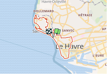
Tocht Stappen van 17 km beschikbaar op Normandië, Seine-Maritime, Le Havre. Deze tocht wordt voorgesteld door philberard95.
Plaatsbepaling
Land:
France
Regio :
Normandië
Departement/Provincie :
Seine-Maritime
Gemeente :
Le Havre
Locatie:
Unknown
Vertrek:(Dec)
Vertrek:(UTM)
289264 ; 5487121 (31U) N.
Opmerkingen